Rio sobre Rochas

CURADORIA

Marcelo Motta de Freitas

REVISÃO

Davi Aroeira

FOTOGRAFIA

Renato Oliveira

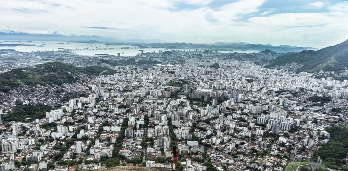
The production of the space we inhabit is the result of various processes accumulated over time in our materiality and social relations. Space is composed of the indissociable set between the occupied area (formed by reliefs, ecosystems, atmospheric dynamics) and the processes of occupation (relative to relations of power, culture, politics, social, and economic): an amalgam that registers, records, and graphs on the ground its unique and exclusive mark, which we commonly call landscape or, more deeply, geography – the graphics on the earth. This landscape is made of visible things and, also, of immaterialities that result from social relations and involve power, economic value, political and cultural interests. Geodiversity, among many definitions, can be understood as the diversity of geological and geomorphological features and processes that interact with culture, modeling the landscape. Rio de Janeiro does not escape this process, expressing very well in its geography the interweaving of buildings over rocky massifs, coastal lowlands, and the different ways of living in such distinct spaces. Each valley carved by a river or each lowland, with beaches and restingas, nestles and accommodates parts of our city and influences our lives. The rocky formations and their dynamics interact intensely with urban daily life, whether with the waterfalls that cool their visitors or the landslides and floods that afflict us in hot and rainy summers. It is not an easy task to inhabit Rio de Janeiro, a city where the relief is not just a scenery — it is the protagonist of the life that pulses between mountains, valleys, beaches, and lowlands. Since its foundation, the city has been configuring itself over this rugged terrain and the influence of these physical dimensions are present, designing the stage of events and shaping its own construction. It is in this unique relief that we inscribe our presence, diverting rivers, filling in marshes, beaches, and mangroves, climbing to the peaks and descending into the subsoil. We were and are forceful in the construction of our own living space. The geological history of Rio de Janeiro dates back to very ancient tectonic movements in continental collisions that forged, in high temperature and pressure, our rocks. Later, the separation of the continents and the opening of the Atlantic Ocean completely altered the relief and raised our sugar loaves, hunched hills, peaks, and serras. Tropical rains, storms, and tempests sought to lash and destroy these formations over the millions of years of evolution of this landscape. Valleys were carved, sediments distributed in low areas, rivers, marshes, and bays formed. Forests and associated ecosystems occupied their habitats with exuberant flora and abundant fauna. Humans recorded their first traces in the Rio de Janeiro and Guanabara region around 8,000 years ago and are associated with the global warming that the planet experienced with the end of the last glaciation. The tropicalization of these environments attracted human hordes who arrived through the Amazon and occupied the hinterland of Guanabara given its abundance of resources: mangroves, marshes, fish, crustaceans, fresh water from various rivers that reached the bay. After these prehistoric peoples came the tupinambás, temiminós, and other indigenous nations who occupied our territory. But this historical account is already in the gallery

Rio before Rio

and here we will deal with the spatial dimension of the facts, thinking about the geography of these processes.
Explore as salas

Rios e cachoeiras

To think of the city from its waters is to assume that, beneath the concrete and infrastructures, another geography pulses—invisibilized, but still alive. Rio de Janeiro is a city made of waters—visible or hidden, strong or soft—that flow down the slopes, cross valleys, and shape the relief before flooding the plains and reaching the sea. The city's rivers, many of which are forgotten under the asphalt or imprisoned in canalizations, are witnesses to the hydric functioning of the urban site upon which the city grew. The “river of asphalt and people overflows the hills, clogs the curb” building a city over the flow of waters that shaped their own paths, fertilized lowlands, and diluted the salinity of the bodies of water dammed on our coast. The Carioca rivers are born in the mountain massifs of Tijuca, Pedra Branca, Gericinó-Mendanha. Crystalline and pollution-free in the midst of the protected forests that maintain moisture and feed our springs, they are still small springs of water that sprout from the rocks and descend in the form of streams, brooks, and larger rivers. In the Maciço da Tijuca, for example, the waterfalls are refreshing features and of appreciation for centuries. Cascatinha Taunay, the Horto Waterfalls, the Cascata Cristalina are places of refuge in the midst of the concrete mass of the built city, where the sound of falling water reenacts a geography that insists on being heard. These waters also feed rivers like the Maracanã, the Trapicheiros, the Joana, and so many others that, although buried in much of their courses, still remain alive, flowing beneath the city, like veins of an urban body that refuses to dry up. In the West Zone, the Maciço da Pedra Branca gives rise to rivers like the Grande, the Camorim, and the Anil, which run through floodable plains before emptying into the lagoons of Jacarepaguá and da Tijuca. They are watercourses that witness the territorial disputes of the “Carioca backcountry” of mills, agriculture, and intense urbanization. All respond to the rainy seasons, overflowing and reminding that the city, despite everything, is still embedded in tropical hydrographic basins. In Gericinó-Mendanha, the smaller rivers hide beautiful waterfalls in territories, historically, further from the city, and, certainly, because of that, marked by contrasts. The less intense use of their slopes preserved excellent forest remnants, now protected, but soon at their foot, the waters encounter lowlands that face the expansion of urban peripheries, their histories and social challenges. The valleys open and the hydrological flows reach the lowlands, meandering the rivers or creating extensive wetlands. However, upon leaving the waterfall-strewn stretches within the massifs, they encounter the city, which decided at the beginning of the 20th century to eliminate the many curves that its meanders drew through the lowlands, replacing them with straightened channels, with the purpose of quickly drying out the low areas, targeted for occupation. The city's hydrographic basins, therefore, spread like networks of memory. Many were straightened, canalized, drained, forgotten. Others resist. Thus, almost all the municipality's rivers, except those within areas protected by legislation, lost their curves and run straight in their lower courses and, naturally (I like the use of that word for artificializations), due to the lack of sanitation, are highly polluted. The waterfalls and rivers of Rio de Janeiro are not just natural accidents: they are structuring elements of the landscape and of history. They are places of ecological persistence and social memory. On their banks, communities were formed, boundaries were drawn, trajectories of urban expansion were defined. In their flows, even today, ancestral memories, hydrological functionalities, and the living behavior of the tropical climate run. Rivers that, in other times, were sources of life, leisure, navigation, agriculture. Today, they carry trash and sewage, but also possibilities of re-existence. Revitalization and environmental education projects attempt to return meaning and presence to these invisibilized liquid bodies. To think about the rivers and waterfalls of Rio de Janeiro is to reclaim the link between the current urban and the functioning of the landscapes before occupation, between the visible and the hidden, between the concrete and the fluid. It is to understand that the city is not only built on firm land, but also on flows—of water, of life, and of time. It is to rediscover, finally, the liquid geography that inhabits beneath our feet, flows through our hills, and that insists, despite everything, in reminding us that landscapes to perceive still resist.

enter

Explore as salas

Quer saber mais sobre a história do Rio?